
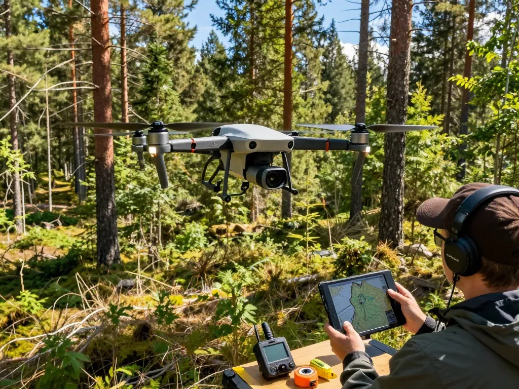
Understanding DJI LiDAR Technology
In recent years, advancements in drone technology have redefined numerous industries, particularly through the integration of LiDAR systems. One of the key players in this domain is DJI, a company renowned for its innovative aerial platforms. The dji lidar systems provide unparalleled precision and efficiency in capturing geospatial data, making them invaluable tools for professionals across various sectors. This article delves into the intricacies of DJI’s LiDAR technology, its features, real-world applications, and future trends to help you better understand its significance in the aerial mapping landscape.
What is DJI LiDAR?
LiDAR, which stands for Light Detection and Ranging, is a remote sensing method that uses light in the form of a pulsed laser to measure variable distances to the Earth. DJI’s LiDAR solutions are specifically designed to work with their drone platforms, allowing users to collect high-resolution 3D data quickly and efficiently. The technology emits laser pulses and records the time it takes for each pulse to bounce back after hitting an object on the ground. This data is then processed to generate accurate topographical maps and models.
Key Features and Benefits
- High Accuracy: DJI LiDAR systems can achieve centimeter-level accuracy, making them ideal for surveying and mapping applications.
- Rapid Data Collection: The ability to collect vast amounts of data in a short period significantly reduces project timelines.
- Easy Integration: DJI LiDAR equipment works seamlessly with existing DJI drone models, enhancing workflow efficiency.
- Advanced Processing: Sophisticated software tools accompany DJI LiDAR systems that aid in processing and analyzing collected data.
How DJI LiDAR Works
The operation of DJI LiDAR involves several crucial components that work in harmony. The LiDAR unit emits laser beams and captures the returned signals to calculate distances. This data is then integrated with GPS positioning information to create detailed 3D maps. The technology allows users to effectively visualize landscapes and assess infrastructure conditions.
Real-World Applications of DJI LiDAR
Surveying and Mapping
Surveying is one of the most prominent fields utilizing DJI’s LiDAR technology. Traditional surveying methods often require extensive manpower and time, whereas LiDAR-equipped drones can cover large areas quickly and provide accurate data. Professionals can generate digital elevation models and orthophotos that are essential for urban planning, environmental management, and numerous engineering projects.
Environmental Monitoring
LiDAR technology has revolutionized how environmental scientists collect data on vegetation, water bodies, and terrain. It facilitates the monitoring of forest biomass, assessing flood risks, and evaluating habitat conditions without significant disturbance to ecosystems. This information plays a critical role in conservation efforts and resource management.
Construction and Infrastructure
In the construction industry, precise mapping is essential for project planning and development. DJI LiDAR assists professionals in creating accurate site models that help assess land characteristics, monitor project progress, and ensure compliance with regulations. Furthermore, as-built surveys utilizing LiDAR data enable construction firms to optimize operations and minimize risks.
Comparative Analysis: DJI LiDAR vs. Competitors
Leading LiDAR Technologies in 2026
As of 2026, various companies have emerged as competitors in the LiDAR market, each offering unique features and capabilities. While DJI consistently sets the benchmark for price and performance, other manufacturers are closing the gap by introducing advanced technology that rivals DJI’s offerings.
Cost-Effectiveness of DJI LiDAR
One of the primary reasons professionals choose DJI LiDAR solutions is their cost-effectiveness. When compared to other LiDAR systems on the market, DJI offers competitive pricing without compromising on quality. This affordability makes it accessible for small to medium-sized enterprises, allowing for broader adoption of advanced LiDAR technology.
Performance Metrics of DJI Technology
Performance metrics such as range, point density, and data fidelity are critical when evaluating LiDAR systems. DJI’s LiDAR solutions typically demonstrate superior results in these areas, which translates to better data quality for users. Factors such as signal redundancy and precision in mapping contribute to the systems’ reputation for reliability within various applications.
How to Maximize Your DJI LiDAR Experience
Best Practices for Operation
To capitalize on the capabilities of DJI LiDAR systems, operators should adhere to best practices including thorough pre-flight checks, proper calibration of the system, and optimized flight planning. Understanding environmental conditions and selecting the right time for data collection can significantly enhance the quality of the results.
Integrating with Other Technologies
Integrating DJI LiDAR with other technologies, such as GIS (Geographic Information Systems) and photogrammetry, can provide comprehensive datasets that enhance decision-making processes. By merging different data types, users can gain deeper insights into areas of interest, leading to more informed strategies in their respective fields.
Common Challenges and Solutions
While DJI LiDAR technology is robust, users may encounter challenges such as data processing complexities and operational limitations in varying weather conditions. Implementing efficient data management techniques and investing in training can help mitigate these issues, ensuring a smooth operational workflow.
Future Trends in LiDAR Technology
Innovations Expected by 2026
The LiDAR technology landscape is continuously evolving. By 2026, we can expect innovations such as enhanced sensor capabilities, greater automation in data processing, and improved integration with artificial intelligence algorithms. These advances will further streamline workflows and broaden the applicability of LiDAR systems across industries.
Impact on Various Industries
The implications of advanced LiDAR technology are vast. Industries such as agriculture, forestry, mining, and urban planning will benefit from enhanced data collection and analysis capabilities. As LiDAR systems become more accessible, expect significant transformations in how these sectors operate.
Preparing for the Future of Aerial Mapping
As we look toward the future, stakeholders need to stay informed about the latest technological developments in LiDAR. Continuous education and adaptation will be crucial for businesses aiming to leverage these advancements for competitive advantage. Investing in training and technology will enable organizations to harness the full potential of aerial mapping.
What industries benefit from DJI LiDAR?
Industries such as agriculture, construction, environmental monitoring, and urban planning significantly benefit from DJI LiDAR. The technology provides high-precision data that is crucial for making informed decisions and optimizing operational effectiveness.
How does DJI LiDAR compare to traditional mapping methods?
DJI LiDAR offers a faster, more accurate alternative to traditional mapping methods, which often involve manual processes and lower accuracy. With LiDAR, users can collect comprehensive data sets efficiently, reducing the risk of human error.
What are the key features to look for in a LiDAR system?
Key features to consider when evaluating a LiDAR system include accuracy, point density, range, ease of integration, and software capabilities. These elements are essential for ensuring that the system meets specific project requirements.
Are there any limitations to using DJI LiDAR technology?
While DJI LiDAR systems are impressive, they may have limitations such as performance in challenging weather conditions and the need for post-processing expertise. Understanding these limitations can help users better prepare for and address potential challenges.
How can businesses implement DJI LiDAR effectively?
To implement DJI LiDAR effectively, businesses should invest in training for their teams, select appropriate projects that leverage the technology’s strengths, and integrate LiDAR data with existing workflows. Doing so ensures both successful adoption and maximized benefits from the technology.